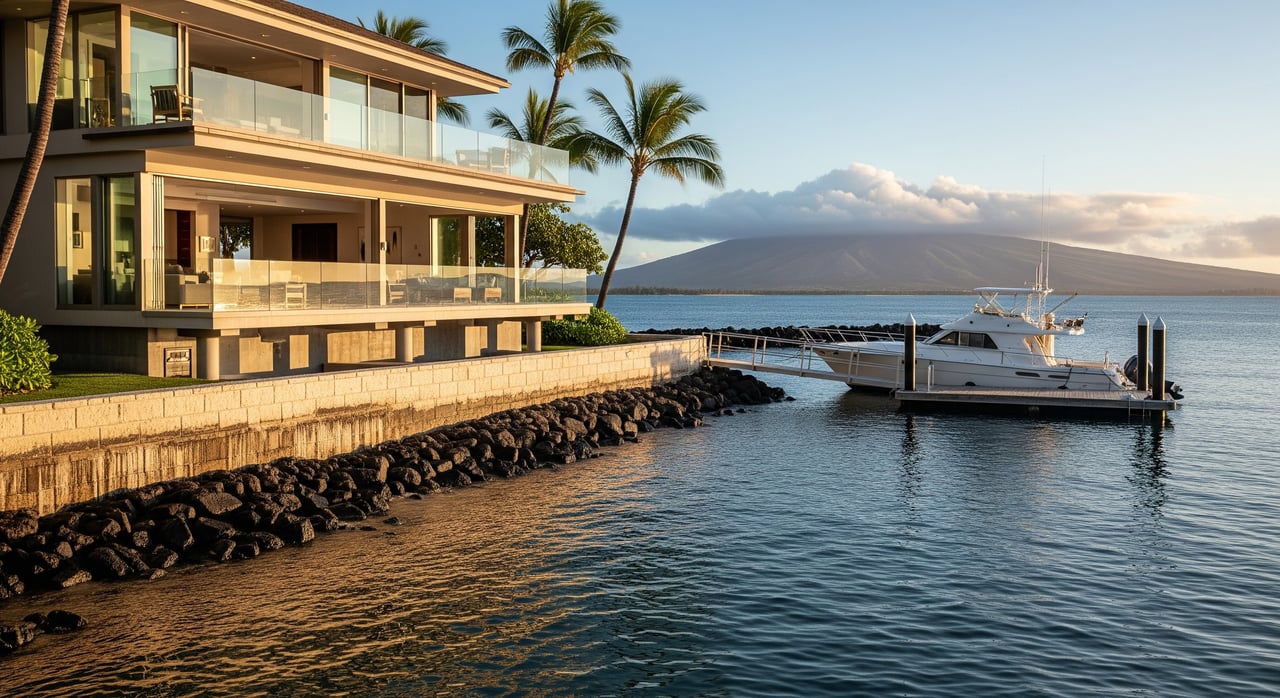
Modern waterfront house with palm trees beside a docked motor yacht, with a mountain across the bay.

Map Your Risk: Flood, Tsunami & SLR In Hawaii Kai

October 16, 2025

Love marina living in Hawaiʻi Kai but unsure how water risk might affect your plans? You are not alone. With many homes built on low‑lying, fill‑created land around Koko Marina and Maunalua Bay, it pays to map your exposure before you buy or list. This guide shows you how to use trusted tools to check flood, tsunami, and sea‑level rise risk, what those maps mean for insurance and disclosures, and the practical steps you can take today. Let’s dive in.

Why Hawaiʻi Kai needs a plan

Parts of Hawaiʻi Kai were created through dredging and fill, which means some parcels sit at lower elevations and on compressible soils. That can increase exposure to high tides, storm overwash, and groundwater rise compared with upland ridge homes. University of Hawaiʻi researchers also report localized subsidence in some developed coastal areas, which can speed up when and where flooding shows up at the parcel scale. You should account for this when interpreting any long‑term map projections. Read the UH findings on localized subsidence.

Know the hazards in Hawaiʻi Kai

Chronic tidal flooding

State materials cite an intermediate scenario of about 8 inches of sea‑level rise by 2050 and about 3.5 feet by 2100 relative to 2020. These increases make high‑tide or “sunny day” flooding more frequent in low‑lying streets, yards, and basements. See state facts and scenarios in the Hawaiʻi Climate Change Portal.

Storm and wave flooding

Annual large‑wave events and storm surge can push water into marina fingers and valley mouths. The Hawaiʻi Sea Level Rise Viewer includes an “annual high‑wave flooding” layer to help you visualize this exposure. Explore it in the PacIOOS viewer.

Tsunami inundation

Hawaiʻi faces both distant‑source and local tsunamis. Low‑lying areas near Maunalua Bay and Koko Marina fall within tsunami evacuation zones. Check your address and plan routes with the HIEMA tsunami evacuation map.

Stream and drainage flooding

Valley drainages in Hahaʻione and Kalama can flood during heavy rain, independent of coastal processes. FEMA’s flood maps capture this riverine risk and are used by lenders and insurers.

Groundwater rise

As sea level rises, the coastal groundwater table can push upward before the ocean reaches your lot. That can affect yards, septic systems, and planting soils. The state highlights rising groundwater as a near‑term issue in its SLR resources.

Local subsidence

Localized settlement of fill can add to relative sea‑level rise at a given parcel. UH findings suggest this can materially shorten the timeline for chronic flooding at some sites. Review the UH summary on vertical land motion.

The three‑map workflow

Use this quick process to see your risk by address.

FEMA flood maps for lending and insurance

  • Go to the FEMA Flood Map Service Center and search your address to see the effective flood zone and panel. Print a FIRMette for your files.
  • Honolulu County has updated flood maps moving through FEMA’s process. See the March 2025 announcement and watch for final effective dates in the FEMA update. Your lender will rely on the current effective panel.

Sea‑level rise viewers for future exposure

Tsunami evacuation maps for life safety

  • Use the HIEMA address lookup to confirm if you are in a TEZ or XTEZ.
  • Identify the nearest safe inland route or designated vertical evacuation structure.

Interpret maps and timelines

  • FEMA maps show current regulatory flood risk used by lenders and insurers. They do not include future sea‑level rise.
  • State SLR viewers show planning scenarios and long‑term exposure footprints. They help you think about 2050 and 2100.
  • Tsunami maps guide evacuation for rare but high‑consequence events. They are life‑safety tools.
  • Local subsidence can accelerate impacts at specific parcels, especially on fill. Consider an elevation survey and, for waterfront or marina fingers, geotechnical input.

Due‑diligence checklist for buyers and sellers

Use this list before you write an offer or go to market.

  • Confirm your FEMA flood zone and print a FIRMette from the FEMA MSC.
  • Check SLR exposure with the PacIOOS viewer. Save screenshots for your files.
  • Look up tsunami evacuation status with HIEMA’s map and plan your route.
  • Order an elevation certificate from a licensed surveyor if the property is near an SFHA boundary or you need insurance quotes.
  • Ask whether the lot was created using dredge or fill. Review county records and seller disclosures.
  • Review seller obligations under HRS 508D, including disclosure of SLR exposure status.
  • If waterfront, consult the City’s shoreline permitting pages. New private seawalls are heavily restricted. See state policy context at Hawaiʻi CZM coastal hazards.
  • If remodeling, ask your contractor about raising utilities, adding backflow valves, and finished floor options.

Insurance, permits, and disclosures

Flood insurance basics

If your home is in a FEMA Special Flood Hazard Area, most lenders require flood insurance. Premiums depend on building elevation relative to Base Flood Elevation and other factors. Start with your zone on the FEMA MSC and use an elevation certificate for accurate quotes.

Seller disclosures in Hawaiʻi

Hawaiʻi law requires a Seller’s Real Property Disclosure Statement. Recent updates call for disclosure of known hazards and whether the property is within a Sea Level Rise Exposure Area. Review the statute at HRS 508D.

Shoreline hardening limits

Do not assume you can install a seawall. State and county policy strongly restrict new shoreline armoring because it speeds up beach loss. Review the policy framework at Hawaiʻi CZM coastal hazards and City guidance at Save Our Beaches.

Local adaptation planning

The City and County of Honolulu adopted Climate Ready Oʻahu and is developing area plans that will influence future infrastructure decisions. Stay informed using this overview of the city’s strategy and timelines in a Climate Ready Oʻahu update.

Practical mitigation at home

  • Prioritize non‑structural improvements. Raise electrical panels, relocate HVAC and water heaters, and add backflow valves on drains.
  • When remodeling, explore raising finished floor elevation where permitted.
  • For parcels on fill, consider a geotechnical evaluation for foundation and soil recommendations.
  • Maintain drains and yard grades to steer water away from structures.
  • For shoreline parcels, coordinate early with the City. See permitting tips at Save Our Beaches.

Uncertainty and how to plan

Sea‑level rise projections depend on emissions and ice‑sheet response, which is why the state presents scenarios rather than a single number. Use the intermediate scenario as a planning reference and track updates at the Hawaiʻi Climate Change Portal. Local subsidence can add to relative rise at the parcel level, as highlighted by UH’s vertical land motion work. Tsunami timing is unpredictable, so always prioritize evacuation planning.

Make your move with confidence

Waterfront lifestyle and risk can coexist when you plan ahead. If you map your exposure, verify your elevation, and align insurance and permits early, you set yourself up for a smooth transaction and long‑term peace of mind. For neighborhood‑specific guidance and a data‑driven plan to buy or sell in Hawaiʻi Kai, connect with Artie Wilson.

FAQs

Which maps should a Hawaiʻi Kai homebuyer check first?

  • Start with the FEMA Flood Map Service Center for your regulatory flood zone, the PacIOOS Sea Level Rise Viewer for future exposure, and HIEMA’s tsunami evacuation map for life safety.

How do FEMA flood maps in Honolulu affect insurance?

  • If your home is in a Special Flood Hazard Area, most lenders require flood insurance, and premiums depend on elevation relative to Base Flood Elevation and other factors.

What does the state Sea Level Rise Viewer mean for my property?

  • It shows scenario‑based future flooding footprints, including passive and annual high‑wave flooding, to help you plan for 2050 and 2100 even if you are not in a current FEMA flood zone.

Are seawalls allowed for Oʻahu waterfront homes in Hawaiʻi Kai?

  • New private seawalls are heavily restricted by state and county policy, so do not assume hard armoring will be permitted for your parcel.

What should a Hawaiʻi seller disclose about SLR and flooding?

  • Provide the required Seller’s Real Property Disclosure Statement and include known hazards and whether the property is within a Sea Level Rise Exposure Area under Hawaiʻi law.

Does local subsidence change my flood timeline in Hawaiʻi Kai?

  • Yes, settlement of fill can add to relative sea‑level rise at specific parcels, which can accelerate when nuisance flooding begins compared with islandwide averages.

Work With Us